
Sally and I visited the area a few times starting around 2003. We fell in love with the undeveloped beauty of the area. We used our sailing kayaks and canoe to access the islands and marshes.

We were captivated by the varied, abundant, and unusual birdlife.

We volunteered with the Nature Conservancy to help gather eelgrass seed to be used in their eelgrass restoration program.

Eelgrass is a key species that helps convert an unstable sandy desert like seafloor into a stable tropical forest like seabed. Eelgrass was almost eliminated from the east coast by pollution and disease in the 1900's. Eelgrass grows in water from 2 to 6 feet in depth. It stabilizes the sea floor and becomes a nursery for a huge variety of marine life. Eelgrass however needs very clear water so that sunlight can penetrate and provide energy for its photosynthesis. Eelgrass is not very tolerant of the nutrient rich, sediment rich, turbid waters typical of our coastal areas. The Nature Conservancy is working with local farmers, industry, and municipalities to use stewardship and best practices as a way of limiting wasteful and damaging discharge into the wetlands. There is hopeful progress but it is slow. It is inherently difficult to put such an intricate web back together once it has been compromised.
Most of these islands are opened to non damaging day use but no camping is allowed. Back in 2007 I dreamed about having a sailboat that would allow sleeping onboard and had the ability to navigate the shallow waters of these islands.
I am always thrilled crossing the Chesapeake Bay Bridge Tunnel. The bridge traverses the mouth of the Chesapeake Bay 17 miles, two tunnels, and a high rise span. It is almost like being at sea. The dramatic breaking waves where current, meets wind, meets shoals are just curiosities when viewed from a car on a bridge, but soon 6mm of plywood is all there will be between us and the sea.
We found our way to the remote village of Oyster and under the curious gaze of some local watermen we started setting up Skorpa. And just as anyone with any sense was getting off the water we set sail, tacking out of the harbor on the ebb tide as the sun lowered into the western sky.

On the one hand I do not want to minimize the very real risks we face. Skorpa is a small lightweight sailboat without any motor. These waters we are entering consist of large bays connected by marshes and inlets. There is a five foot tidal range so great areas of what looks like open water in a few hours is transformed into mud flats and oyster bars and the calm inlets become raging rivers roaring out to sea and six hours later roaring back in. There are few landmarks because one tidal marsh looks pretty much like the next one. Channel markers are far apart, sometimes missing, or sometimes the channel has moved leaving the marker on ground obviously not suited to navigation by boat.
I had in my notes the times of the tide changes, I had charts, my GPS and backup, spare batteries, marine radio, cell phones, spare clothes stored in dry bags, food and water. We had a superbly designed, well built boat and we knew how to make her sing. We knew when to move and when to lay low, and we knew that despite all that.

A pair of raptors were taking up residence on an abandoned chimney near our first night anchorage at Cockle Point Creek. After checking out the raptors we decided to head up Cockle Point Creek into the Elkins and then the Eckichy Marshes. The tide was ebbing but we had a gentle NW breeze that might make it possible to retrace our steps if the channel faded.

We spotted egrets, oyster catchers, wimbrels, terns, and a bald eagle. We anchored and enjoyed watching the birds and spending some time in the cabin out of the sun. After lunch we decided to attempt to travel further north into the marsh hoping to reach the outlet at Gull Marsh Channel. On the chart the channel faded and there were no depths marked. As we proceeded the water gradually became more shallow. We had to raise the centerboard up and up, then the rudder had to be raised up and up. I knew we were close to where the water would begin to deepen. We came to a stop and I got out the binoculars and looked around. I could see we had missed the exit by a hundred yards or so. We would have to retrace our course and stay further west. In many sail boats turning around in such shallow water would be difficult or impossible, but all we did was push out on the mizzen until the stern swung around and then push out on the main until the bow came around to our new course.
We were feeling pretty pleased with ourselves until we reach the channel where the now flooding tide was pouring in. We needed to tack up this channel and for that we would need the centerboard down and it refused to budge. There happened to be a flock of laughing gulls and they were making an especially raucous chorus. The current was threatening to drive us onto a shoal so we dropped the anchor until we could persuade the undoubtedly sand clogged board to drop. Sally decide to name the area Laughing Gull Pass. Once we made it through the Pass it was running before the wind down the Machipongo to Hog Island.
We had Pasta for dinner and a very quiet night at our anchorage between Hog and Rogue Islands. And no bugs. Light winds usually means lots of mosquitos. The next morning we anchored near the southwestern tip of Hog Island and went ashore for a walk and explore.

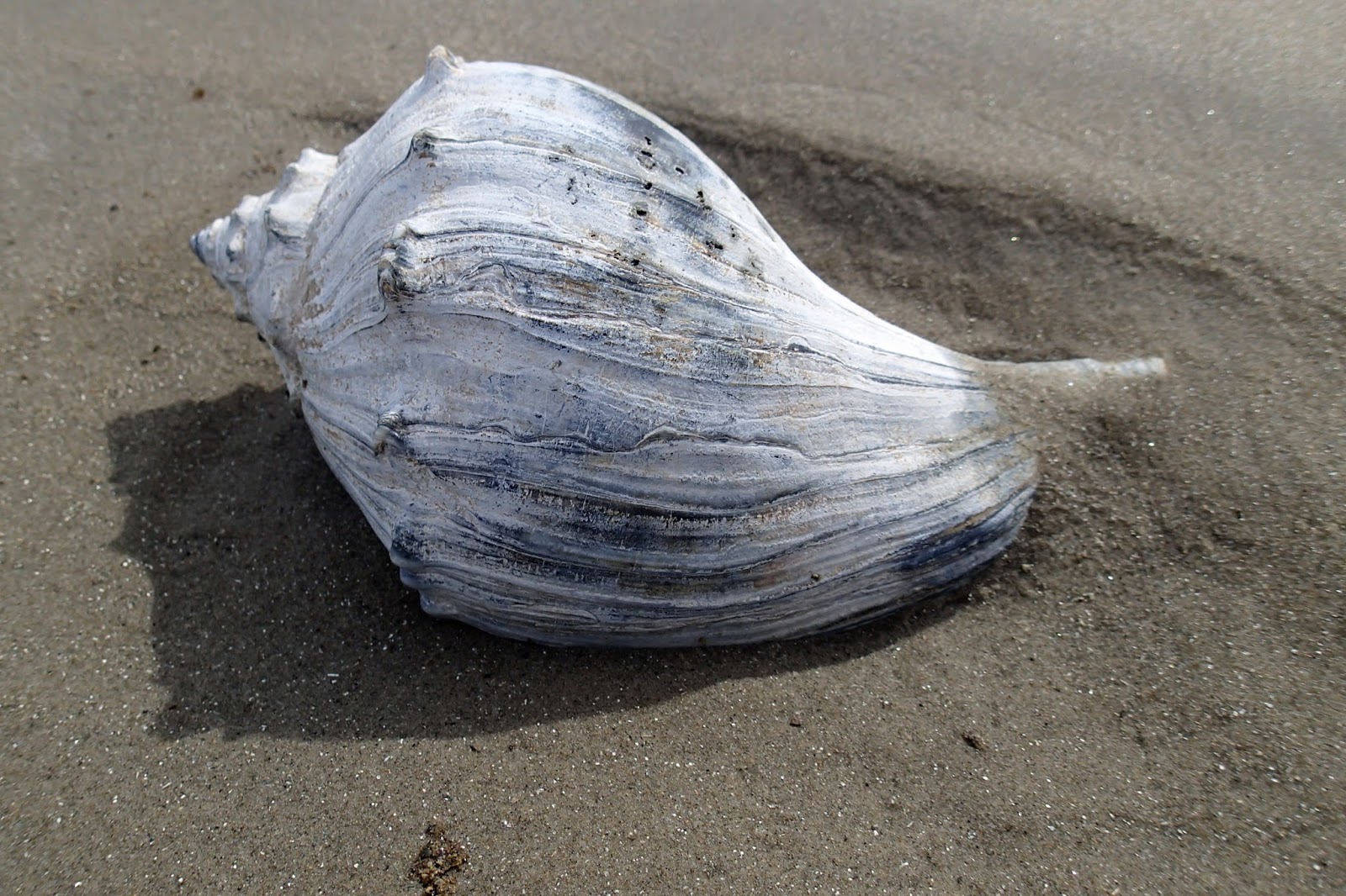
Beach combers do not make it out here very often. Lots of nice shells, but we took only pictures.


Hog Island belongs to the Nature Conservancy. They ask that you stay below the high tide mark to avoid disturbing nesting birds and to avoid damaging the dune grasses that are charged with the difficult job of stabilizing this pile of sand against the forces of wind and waves.
I am not sure if the buoy moved to the beach or the beach moved to the buoy.
We had lunch and a little rest out of the sun in the cabin while the tide bottomed out and began to flood. We decided to cross the Machipongo and head for Rowes Hole Channel then try to cross Big Easter Marsh while the tide was rising. We would look for an anchorage near Little Cobb Island. One concern we had was the breaking waves we could see well up the Machipongo in the vicinity of Rowes Hole Channel. The breaking waves were an indication of shallow water and if the wind should decrease any it could leave us at the mercy of the current. The crossing went well until we were on the far side when we had to use the paddle to help get us around some nasty looking waves breaking on a sandbar. After that it was pretty smooth sailing as we rode the flood tide around the west side of Big Easter Marsh. The water depth decrease to about a foot and we could see Eelgrass for the first time. Soon the water began to deepen as we reached Loon Channel which would lead us down to Little Cobb. And sure enough we could hear a couple of Loons and see them diving in the Channel.
We sailed slowly back and forth just north of Little Cobb while I sounded the bottom for adequate depth. The ideal anchorage is deep enough to leave plenty of water under your keel even at dead low tide, it should be out of the current and channel, it should be sheltered from wind and waves from the prevailing or predicted direction. And you should be able to sail out of your anchorage easily even if the wind should change direction. Most of the deep water around the Barrier Islands is in the inlets where it can be 50 or 60 feet deep. It is that deep because the current has scoured all the sand out.
So even though I was not really pleased with our anchorage I felt it was the best we were likely to find. We were out of the current with about 6 feet of water even though the tide was not yet high, but there was not much to block the wind and waves from the north and to our lee was Little Cobb Island.
I did not think much of it because the wind was light as I set the anchor. Half way through our dinner of rice and vegetable the wind suddenly picked up until the rigging was humming and the boat was rocking. I went forward and it was blowing over 20 knots. I could tell by the marks I have on my anchor line that we had forty feet of scope out. As I let out another forty feet the boat began to pick up speed. I ran the line around a cleat and began to bring the boat to a stop. The line went taut and put a good strain on the anchor but she held fast. That should hold up to a pretty stiff blow and it blew and the boat rocked for the first half of the night.
The wind eased by morning and I thought if we got an early start we could make it across South Bay during high water. Just as we were getting ready to leave the wind began to build again. I set two reefs but the wind kept building to over 20 knots from the North. We can sail the boat in that much wind but we have to be on our toes and things come at you pretty fast. I did not want to push things in such unfamiliar and isolated waters. So as much as I hated to, we decided to wait. We read and watched some dolphins and I could see that we were missing our chance to cross South Bay.
By 11am the wind was veering a little to the Northeast and I thought it was losing a little of its punch.
Loon Channel narrows and swings between Cobb and Little Cobb before entering Sand Shoal Inlet. There had been a significant settlement on Cobb Island and the channel looked like it was strewn with old pilings. I did not fancy going that way driven by such a strong wind which meant we would have to sail around the western end of Little Cobb. The chart just showed this area as shallow, exposed at low tide, no depth indicated. We could not see any breaking waves so I thought we would be OK but I did not want to wait any longer as the tide was ebbing strongly. So off we flew.
The general plan was to work our way southward toward Myrtle and Smith Islands while the north wind blew and then head north back to Oyster on Thursday when the winds were predicted to change to southerlies. Since our delayed departure caused us to miss the high tide we would travel west up Sand Shoal Inlet then south down the Mockhorn Channel. Not as interesting perhaps as the marshes of South Bay but c'est la vie.
Studying the charts I noticed an interesting twisty "Short Cut" that led into a shallow bay. We decided to check it out.
Mockhorn Island lies between the barrier islands and the mainland. It appears large on the map but most of the island consists of Spartina marsh that is inundated at high tide. The high ground sustains some scrubby cedar trees and bay laurels. There are two lookout towers built in the 1940's that were intended to direct the fire of large guns located on the mainland. There is also an old home, barn, and outbuildings, in various states of decay. We sailed by all these. Our hope was to sail across Smith Island Bay, and up the Main Ship Shoal Channel, perhaps as far as Mink Island. When we rounded the southern tip of Mockhorn and headed up into the wind the large fetch and shallow water made for an uncomfortable chop. It was only 4pm and we had spent most of the morning waiting at anchor for the wind to ease, but still we did not feel like fighting our way upwind for an unknown anchorage. So we came about and slipped back into the lee of Mockhorn. Our only difficulty was sounding for sufficient water depth.
Larimer A. Cushman who made his wealth in his family's baking industry purchased Mockhorn Island in the early 1900's. He improved on the existing hunting lodge and began to construct an impressive, largely self-sufficient estate. When I first examined the buildings I imagined that he must have been in the concrete business, the walls are all covered in reinforced concrete stucco, even the shingles are concrete.

Sally is sitting on part of the concrete pier, behind her you can see part of the concrete walls that surround the high ground.

The house is hidden behind a jungle of vines and shrubs. The concrete capped chimneys look to be in excellent condition.

The barn was added by T.A. Jones who bought the island from the Katherine Cushman in 1948.

T.A. Jones must have had an eye for detail and quality of construction.

The roof and walls all appear very straight and true.
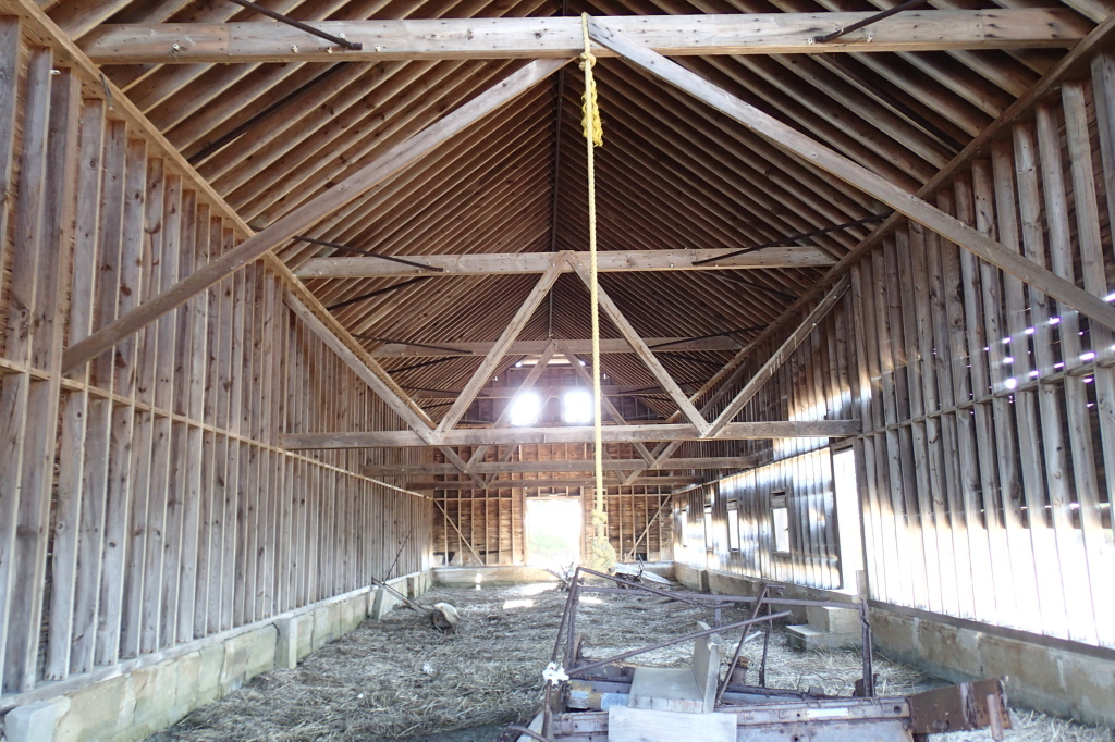
Diagonal bracing let into the walls, simple but very well done.

The diagonal line is where a downspout was located. I suspect freshwater was in short supply making collecting rainwater a priority.
These shingles look similar to slate, but I think they are a manufactured concrete product.

All the shingles I could see on the barn and house looked in excellent condition. These are from a collapsed outbuilding.

This is a view across one of the seawalls. The trees mark the high ground and the house site.
These islands and marshes are a paradise to all sorts of marine and bird life.

Sipping my coffee in the predawn darkness it seemed a bit lonely and forbidding to me. Forbidding is not quite the feeling more like filled with a presence.
The new connectors battery powered boat.
ReplyDelete