Sunday, September 15, 2019

Sailing to Nantucket 2019


August 19, 2019

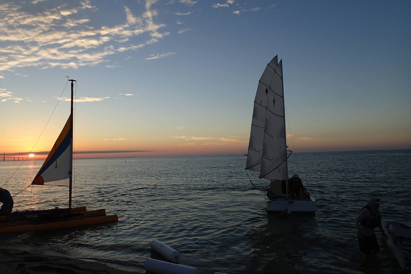
 I left Point Judith Pond just at dawn. There was a light southwest wind. The current in the breach way would be at maximum flood at 8:45am. The sooner I could get to the breach way the less current I would have to sail against. If I couldn't make it out I would have to delay my departure a few hours until after the current eased. I was beginning my 225 nautical mile trip from Point Judith to Nantucket and back. I was already juggling currents and schedules.


My plan was to sail up Vineyard Sound between the Elizabeth Islands and Martha's Vineyard to Tarpaulin Cove. The next day  I  would sail around the northern end of Martha's Vineyard and into Nantucket Sound. Day three would be a sail across Nantucket Sound to the Island of Nantucket.


GPS Track 2019 Trip to Nantucket

The currents in Vineyard Sound and Nantucket Sound often run 3 or 4 knots.  That may not sound like much just a brisk walking pace and to a power boat not of much consequence. In my sailboat without an engine that amount of current could easily bring me to a halt or push me back. When I reached the Point Judith breach way the current was rushing in and I wanted to sail out. Not quite at max but getting there. I was close hauled to the wind which was partially blocked by the buildings surrounding the gut. I snuck out by hugging the eddies that are close to the rock walls of the breach way. Once free of the breach way I could run before the wind on a course for Tarpaulin Cove on Naushon Island.

The tidal range around the Martha's Vineyard and southern Cape Cod is a fairly modest 3 to 4 feet. Yet the currents in and around the islands are strong. And sometimes the direction of those currents have not made sense to me. But now I think I am beginning to understand. The currents of Nantucket Sound are driven not only by the rising and falling of the tides in the area, they are driven primarily by changes in the ocean level in the Gulf of Maine and the Mid Atlantic Bight. Cape Cod divides these two areas that have dramatically different tidal ranges and times.

I found this neat Giff put together by someone at the University of Massachusetts School for Marine Science and Technology.


The arrows indicate direction and strength of the tidal current flow. At the same time water is flowing into the eastern end of Nantucket Sound water is flowing out between Martha's Vineyard and Nantucket. The only explanation can be that water is sloshing back and forth around Cape Cod between the Gulf of Maine and the Mid Atlantic Bight. This makes navigating the area in a sailboat look like a nightmare. The Giff though is playing a six hour tide cycle in just a couple of seconds so it is not as bad as it looks. Still sailing between the islands can take a few hours and in that time the currents can reverse. You can start a crossing with the current in your favor but the tides are apt to turn before you reach your destination. Sailor beware. 

I want to bring up another issue, water depth. My boat draws about 4 feet of water with the centerboard down and only about 6 inches with the board all the way up. There are a lot of shoals in Nantucket Sound but most of them have a water depth greater than four feet. So you might think that water depth would not be much of a concern for me except for two other factors, currents and waves. Currents accelerate when they are forced over shoals. Ocean swells rise and steepen when they reach shallow water. Waves also rise and steepen when they meet an opposing current. In Nantucket Sound conditions can go from manageable to treacherous pretty quickly.

I had a smooth crossing from Point Judith to Tarpaulin Cove. The wind was modest and from abaft the beam. The only issue was some fog that would occasionally drop the visibility to around 1/2 mile. Numerous large cargo ships ply these same waters going in and out of Narragansett Bay and up Buzzards Bay to the Cape Cod canal. I kept a sharp eye out for them and tried to spend the minimum time in the marked shipping channels. The fog cleared by the time I made it to Cutty Hunk and I was having a peaceful sail up Vineyard Sound when the main sprit boom suddenly dropped to the deck.
I hove to and went forward to find the block holding the sprit to the main mast had chaffed through. I was able to repair it easily with some spare line, but it made me wonder if I should have checked the rigging more closely.

After a quiet night in Tarpaulin Cove I set off early. The current in Vineyard Sound would be running against me until 9am but I wanted to take advantage of the northwest breeze  which would fade later in the day. As I sailed out of the cove wing and wing and somewhat by the lee I crossed just astern of a sloop sailing close hauled. Her skipper called out to me that Skorpa looked like she was designed for that point of sail. With her sails spread wide before the wind she was cutting into the current with a bone in her teeth.

By the time I got to West Chop, one of the headlands on the northern side of Martha's Vineyard the wind had grown light and the tide had begun to flood strongly. The water was flowing under me almost as fast as I was moving so I had very little steerage. I was like a little stick floating down the river drifting between  West Chop and East Chop. One of the ferries  cutting across in front of me on its way into Vineyard Haven blasted her horn at a power boat that was in her way. The little power boat opened her throttle and sped out of the way. I had no such option. I was glad I wasn't a few minutes earlier or the ferry a few minites later.

The current was so strong and the ferry traffic so heavy I made a mental note to consider returning by another route. The wind had grown light and it was getting late in the day. I knew there was no way I could make it all the way to Nantucket so I started looking for a place to anchor for the night. I was not inclined to go into Edgartown, though I am sure it has plenty of yachts and moorings. Nearby is the shallow and secluded Cape Poge Bay on Chappaquiddick Island and that is where I headed.


 I found a snug little bay nestled up against a marsh and some barrier dunes not far from the Cape Poge Light.


I walked along the edge of the marsh in a couple of feet of water bringing my boat with me. Schools of minnows darted in the clear water fainting and turning hundreds moving as one.


Cape Poge Light sits on a lonely area of sand and woods looking out on Nantucket Sound.


I wanted an early start for the crossing to Nantucket so I breakfasted and dressed while it was still dark and I raised sail while a few stars were still in the sky. The weather forecast called for a chance of thunderstorms. I reasoned they most likely would come later in the day, so an early start would get me to Nantucket before they arrived. The sky was clear with a light wind from the southwest. Far off on the western horizon I could see frequent flashes of lightning.

After I rounded Cape Poge I could see there was very little ocean swell. I decided to run straight across the shoals between Chappaquiddick and Nantucket. As I approached Howes Shoal, Norton  Shoal and Long Shoal I could see  eddy lines and changes in the wave patterns. On my GPS I can access stations that give current speed and direction for a number of locations. I checked the station located in a channel between Long Shoal and Norton Shoal. I had a current of 1.4 knots flowing 114 degrees Magnetic, roughly along my course. Passing over the shoals I could at times see bottom but I am unsure of the depth  around 10 feet I would guess. I find it difficult to judge water depth because a variation in water clarity can throw off your estimate by a lot.

By the time I passed Tuckernuck Shoal my attention was drawn to the darkening sky off to the southwest. It was around 10 or 10:30am and I was still about 6 miles from Nantucket. I tuned into the marine weather forecast. They were announcing a severe thunderstorm warning for the area and urged all mariners to seek safe harbor. 


By 11am the clouds had darkened and lowered. They had a strange greenish color and were dramatically three dimensional. I abandoned my plan to reach Nantucket harbor before the storm hit but hoped I could reach within a mile or so of the shore where the water was about 20 feet deep and I could anchor and lower my sails and wait out the storm. 

Soon though the wind increased, rain began, and visibility dropped. Continuing to sail even if double reefed seemed out of the question. The only question was had I waited too long. Would I be able to get my sails down and secured before it was too late. 

I grabbed some ties, freed the main halyard and went forward to tie down the main. The wind was howling, the rain pouring, and the thunder roaring. Yikes. All the stories I had heard or read of small boats capsizing came to mind. I tied the main down as well and as quickly as I could and while I was up forward I grabbed the anchor and tossed it over. Then I hurried aft. Crew standing up in the bow can make a small sailboat more likely to capsize.


I marked my GPS track where I dropped my sails and again where I raised them and got underway after the storm had passed. I decided to lower the mizzen. I am not sure if this was a good idea. The mizzen was keeping the boat pointed into the wind and waves. With the mizzen down Skorpa began drifting broadside to the wind and waves. The anchor had gone out with 140 feet of line but there was no sign of it holding. I began to worry that it might suddenly catch and jerk the boat around. The anchor might become entangled preventing me from retrieving it, but there was no way I was going back up on the foredeck until the wind eased off. That was the hardest part I did not know how long the wind would continue to howl or if it would increase in speed. The waves began to build and some broke into the cockpit, I huddled on the windward side hoping my weight would help keep her from going over.

It was more than half an hour but less than an hour and the wind began to ease and the waves to diminish. I went forward and pulled in the anchor. It offered no resistance. Then I raised the mizzen and began straightening up the cockpit. I felt a little dazed. I was shivering. I could see a boat coming straight for me its bow high in the air. The SeaTow boat pulled right alongside and a young man asked if I was OK. I said I think so like I was not too sure. He flashed me a thumbs up sign and I gave him a thumbs up in return. He roared off. Just before the storm had hit I saw a few boats go racing by heading into the harbor. One of them must have let SeaTow know that a small sailboat had not made it in.

The wind had dropped to around 10 knots but I put two reefs in the sails. The sky was still dark off to the south and I just was not going to take any chances. I laid out some lunch so I could eat as I sailed towards Nantucket Harbor.


The lighthouse at Brant Point was a most welcome sight.


The deep water in Nantucket harbor is crowded with vessels of all kinds.

The waters of the harbor extend 4 miles to the northeast, but the average depth is around 4 feet.


Perfect for small boat sailing.


This photo is looking out the harbor entrance on Wednesday morning. I anchored Skorpa in close to the beach at Brant Point and hopped out for a walk around town.


There is a feeling of old money in the tree lined streets, sidewalks and roadways paved with brick and cobblestone and well preserved 19th century buildings.


Near the ferry docks the streets are crowded with tourists unloading from all over the world. Strangely similar but oddly different from 19th century Nantucket.


Thursday I sailed early on the first leg of my return to Point Judith. I sailed close by Tuckernuck Island and Muskeget Island to the Muskeget Channel. I met some stiff winds and chopping seas and sailed an hour or so under mizzen alone. When I reached the Muskeget Channel I had the choice of
sailing across the southern end of Martha's Vineyard or heading around Cape Poge and back the way I had come towards Vineyard Haven and Woods Hole and all the ferry traffic and strong currents.

The southern coast  of Martha's Vineyard has no harbors no good places to seek shelter. A weak front was coming through so there were dark skies and gusty winds. I decided to take my chances with the ferries and currents.


The winds grew light and seemed to shift to always be on my nose. But finally after a glorious sunset over Woods Hole I coasted into Tarpaulin Cove around 9pm.


By morning the front had cleared and a fresh breeze was blowing from the north. I had some near perfect sailing conditions for the last leg back to Point Judith.


Thursday, June 13, 2019

Florida Everglades

 March 2019

This is our third trip to explore the Florida Everglades with our 22 foot shallow draft sailboat, SKORPA .Our first trip involved sailing down the Gulf Coast of the Everglades exploring the Keys, Mangroves, and bays south from Chokoloskee to Ponce De Leon Bay. Our second trip was a voyage across Florida Bay from Flamingo to Key Largo.


 This third trip is an expedition up the Lostmans River and along a portion of the Wilderness Waterway, to the headwaters of the Broad River and then down the Broad River back to the Gulf of Mexico, a little over a hundred nautical miles.
The Wilderness Waterway is a series of canoe/kayak trails that allow a paddler to travel over a hundred miles from Chokoloskee to Flamingo along a network of Bays and Rivers in the Everglades National Park. The trail is customarily used by canoes, kayaks, and small powerboats with big engines. There are some very shallow areas and some constricted passages, but we have heard of small sailboats exploring at least some sections of the Waterway.
We began our trip to Florida with a stop at Fort Desoto Park for the start of the Everglades Challenge Race. We know several of the participants. We enjoyed wishing them well and sending them off into the beautiful dawn on their 300 plus mile journey to Key Largo.
Godspeed to Alan and Paul Stewart in Southern Skimmer.

Fairwinds our new friend Schappi aka Joachim Harpprecht.
 

Sally and I left the adventurers to find their way down the Florida Coast. We drove down to Chokoloskee, about half way along their route and launched our own boat, SKORPA. While not a race proven boat, she is a B&B Yachts EC22 a race proven design, and SKORPA is most certainly expedition proven. Since 2012 the three of us have logged well over a thousand miles exploring the Atlantic coast from New England to the Florida Keys.

We were able to get our boat rigged and launched by 4pm Saturday. The tide would soon be turning and we had already had a long day so we spent the night tied up at the dock. There was a Spring tide and by morning we were partially aground, soft mud fortunately and not oysters. We planned to wait until almost noon when the tide would be near high so we would leave with the falling tide. When you have no motor your schedule is heavily influenced by the wind and tides.

Somehow we missed a tack on the way out Rabbit Key pass. The ebbing tide pushed us up against some mangrove trees and we were stuck. I knew this could be serious. If the mast hung up the increasing current could capsize us and or damage the boat. We struggled to push off the branches and free the boat, but we just wedged further into the mangroves. We got the sails down and tried paddling but to no effect. I got one of the oars out and was able to pole off the bottom. We pushed and paddled with all we had and slowly the stern swung free of the mangroves and out into the current. The increasing following current had limited the rudders ability to control the boat and our voyage had nearly come to a premature ending. Must be extra careful.


Above I am checking my GPS, and below Sally is watching the compass as she heads the boat south towards Lostmans River. The low lying and relatively featureless keys and mainland make it difficult to keep your orientation without some navigational aids.


 Sally was a little shaken by our near calamity and wanted to stop early. I encouraged her to keep on and promised to have us at anchor by 4pm. She felt better after awhile and was glad we continued on to Pavilion Key.


We had a quiet night just southwest of Pavilion Key. We decided to weigh anchor before dawn so we could make it to Lostmans River while the tide was flooding. That would increase our chances of making it up to Third Bay, or Lostmans River Bay.


Thanks to our early start we made it to the mouth of the Lostmans River by 8:30am. The tide was still pretty low so we had to pick our way carefully through the shoals at the entrance. Once we cleared Lostmans Island we found a little more water and with a flooding tide and a following wind we were making good progress.  Much of the landscape in the lower Lostmans looked familiar to us from our trip three years ago. As we sailed up the river we were trying to locate our previous trips furtherest point of progress where we stopped for lunch before turning around continuing down the gulf coast. We passed the tower at the abandoned Ranger Station and then the water monitoring station.


When we saw Second Bay opening up before us we knew we were beyond our previous trip. We continued to have a favorable current and wind about 10knots almost dead astern. We crossed Second Bay and sailed between some island right into Third Bay.


We decided to stop for lunch in a little cove in Third Bay. We were really pleased to have made it all the way up to the Wilderness Waterway so easily. Over lunch we checked the weather and discussed our plans.


We could explore the Wilderness Waterway near the head waters of Lostmans River and then return back down Lostmans. Another possibility would be to head towards the Broad River. I did not know for certain that we could make it down the Broad River with our sailboat. The River might be too narrow or clogged with trees.  We had two days of fair weather and then a strong front would come through bringing gusty northeast winds. We decided to take small steps towards the Broad River stopping along the way and reassessing our situation.


We headed south and east leaving Third Bay and following the Wilderness Waterway into Big Lostmans Bay. I felt like I needed to pinch myself. I could not believe we were sailing the Wilderness Waterway. The wind was about 10 knots west southwest. The bays are relatively small so there were only little wind waves and we glided across the water like magic. The bays are only a mile or two across at the most so our progress seemed almost too fast. Unlike sailing the Gulf or a large Bay where progress is not easily detected and it takes several hours to make your next landmark. Before we knew it we were across Big Lostmans Bay and hunting for the passage into Rogers River Bay. The passage opened easily before us and we dropped down into Rogers River Bay. We rounded up into a little cove and dropped our anchor. I checked for a cell signal and as I suspected found none. We had not had a signal since Pavilion Key, and that was a poor one. This was our Rubicon if we went any further south we were committing to the Broad River. We considered staying the night in our little cove but it was small and exposed to the south. We still had some daylight left and the conditions were near perfect. The Wilderness Waterway follows the eastern shore and goes through some narrow channels that would require sailing upwind around some marshy islands. We chose a route to the west that looked more open and favorable with this wind direction. Our course took us right by the Rogers River Chickee. Just a platform in a pretty little finger of a bay. There was no sign of anyone.


We rejoined the Wilderness Waterway sailing along the western edge of Cabbage Island. We began to get a little concerned because we were not seeing a good spot to anchor, but then poking into the entrance to the Broad River we found a wonderful little spot, protected on all sides and with a Cabbage palm tree to mark it.


I think Sally looks pleased. We are in the heart of the Everglades about midway through our trip. Tomorrow we start working our way down the Broad River and back to the Gulf.


Tuesday morning was foggy with 5 knots of wind from the west. The current would be ebbing strongly in the morning so we decided to explore a bit around Cabbage Island until the current slowed a bit. There two ways to enter the Broad River. The Wilderness Waterway takes the Eastern branch which has a tight S turn. We thought this might cause a problem forcing us to sail upwind or around debris. We entered from the west which is wider and straighter and joins up with the other entrance in a half a mile or so. We started noticing Bromiliades. Flowering plants growing in the forks of dead trees. We lost our wind so we began to row slowly mostly to keep the boat centered in the river. The current was 1 to 2 knots. We noticed some shoaling when we met the eastern fork but no problems. The river was about 50 feet wide. No trees hanging in or over the water. Just quietly drifting watching for alligators.


When we reached the Broad River Bay we turned east towards Camp Lonesome. When the Bay began to narrow significantly we came about and headed west. The wind began to pick up veer west and with sharp gusts. Dark clouds rolling low and fast. The wilderness seemed a little less friendly. We were close hauled and tacking straight up the bay so progress was slow. We dropped anchor near the northern shore and tucked in a reef. We continued on until the bay narrowed and the river began. We anchored as close to the north shore as we dared and tied everything down well.  We were expecting a strong front to come through overnight and the winds to increase and continue to veer to the north or northeast.


Below is the view looking west where the Broad River leaves Broad River Bay. This area has a tidal current of around 2 knots. The current flows west down river during the ebb tide, then it reverses and flows east during the flood. During the night the wind became quite strong and gusty form the north. When it was quiet in between gusts the boat would swing to line up with the current then a gust would come howling across the marsh and catch the boat broadside. The boat would shake and the masts fibrate as we swung to face the wind. Then the wind would ease and the boat would swing back to the current and several minutes later the wild gyration would repeat. Later we would learn that a veteran Watertriber would be forced to abandon his boat and call for a Coast Guard rescue in the Gulf not far from where we were swinging at anchor.


During the night we were surprised to hear voices and see a light in the distance. Watertribers no doubt making there way to Key Largo. Wednesday dawned clear, the wind from the NE 10 knots with some higher gusts. We considered leaving but decided to spend another day in the Bay to let the weather settle down. Later in the morning we spotted a few more Watertribers in kayaks some sporting sails heading west down the river. A couple of them came close enough to exchange a few words. They mentioned how wild the wind was last night.


Thursday morning dawned clear and cool. A manatee drifted down river I could only see a little of his snout as he surfaced to breathe. The sound of a large mammal surfacing to grab some air was unmistakable. We started down the lower Broad River under oars drifting slowly with the current. We were using the oars primarily to keep our boat centered in the river. After an hour or so the wind picked up and we put up our sails.


The sail down the lower Broad was beautiful but uneventful, but in the last 1/2 mile or so the river widens and is littered with small mangrove islands and sand bars. We were nearing the end of the ebb tide so the water was quite low. We followed a narrow channel of deeper water along the south bank of the river. I was relieved when we arrived at the mouth of the river but actually the most difficult part lay ahead. A huge delta stretches over a mile into the gulf most of it only a foot deep at low tide. Our GPS chart showed a narrow channel twisting off to the southwest through the shoal. The channel though is constantly shifting so we had to try to read the water for signs of the channel. The water color was not very helpful it was all various shades of light brown. After a few light bumps and scrapes we sailed free of the shoal and could set our course north towards Chokoloskee.


We stopped for a little shore leave at Plover Key. We had a pleasant walk along the sandy beach. We found lots of interesting drift wood and shells to admire.


We had some lovely visits from dolphins while at anchor near Plover Key, but they refused to pose for pictures.


Sally coming ashore at her favorite key in all of Florida. Turtle Key!


We marveled at the Mangroves that have adapted to live in this harsh spit of sand.


Turtle Key is four or five miles from Chokoloskee. You frequently see power boats and kayaks so it feels like you have returned to civilization. After 6 nights  on our boat in the Everglades we were ready for a little civilization. We had no reservations and the first three hotels we tried had no vacancies, in desperation we tried the Rod and Gun Club and they had a room for us


A trip to Chokoloskee would not be complete for us without a meal at the Havana Café.


Wednesday, January 16, 2019

Portsmouth Island

Every year for the last eight years or so Sally and I have attended  B and B Yacht's small boat gathering. We often take the opportunity to explore the bays and rivers near Chapel Creek, the home of the Messabout. I have documented these trips in prevous posts.

Exploring Mouse Harbor

This year 2018 Sally and I in Skorpa, joined Jay and Carol in their CS 20 mk3, and Graham in his CS17 mk3 on a trip from Chapel Creek on the Bay River across the Pamlico Sound to the Outer Banks of North Carolina.

We started with a brief captain's meeting. About 2pm Sunday we set sail down the river. Sally and I had double reefs as the wind was still gusting quite strong though would likely decrease as the afternoon wore on. The other two boats were partially reefed. I thought that the other two boats would soon leave us behind because they had so much more sail up, but Graham later explained to me that as long as each of the boats had enough sail up to drive their boat up to hull speed that the boat with the longer water line would be faster. On top of that the EC22 hull is more easily driven up onto a plane and thus beyond its hull speed. Some of the gusts were still strong enough to send us a little beyond hull speed so to my surprise we pulled ahead of them. Every now and then we would double back so we could enjoy the sail down the Bay River together.  Around sundown we headed into Bonner Bay and found a quiet anchorage in Riggs Creek.


As we drifted back on our anchor we came along side of Graham's boat so we rafted up for the evening and shared some after dinner tea and chocolate. I carried our stove box out to the cockpit and cooked our meal out in the open. You can see the stove glowing in the photo. There were no mosquitos!


We decided to leave in the morning at 7:30am to allow plenty of daylight for our crossing.


We had a north wind around 10 kts.  Absolutely gorgeous conditions. Jay took this photo  from Southern Express as we set out across the Pamlico Sound. Carlita is in the center and Skorpa is off to the right.


An advantage of sailing in a group is you can get some great shots of your boat from your fellow sailors. This is Skorpa heading across the Pamlico Sound to Portsmouth.


As we approached Portsmouth I could see that Graham and Jay were heading further East toward the Wallace Channel so we headed up to join them. When we were about 5 miles out the wind faded on us. Jay and Carol motored in. Graham waited for us near Shell Castle then he too headed in and we followed. Graham and I headed west shortly after rounding Ayers Rock while Jay had seen a large Sport Fishing boat leaving so he proceeded further south in the Wallace Chanel before heading West on a heading of 255 degrees.  That was the channel we would use when we left for Ocracoke. Graham and I had to feel our way across the shoals. It is also possible to approach Portsmouth from the West. The preferred route depends on the tide and the set of the currant. We had about half tide and a flood currant.


Coming into the dock at Portsmouth. Jay and Carol greeted us and helped us tie up. The mosquitos were out in force so we all decided to retire to our cabins. We put up our screens got rid of the skeeters that had snuck inside and fixed our dinner. That was by far more rowing than we had ever done in Skorpa much of it was against the current and Sally had done more than her share of the rowing. We had a quiet night, though I did notice that sometime after midnight the current reversed. We were treated to a beautiful sunrise. This is looking across Ocracoke Inlet.


 Monday morning as we are about to set off on a walk around Portsmouth Village. From left to right that is Graham, Sally, Carol and Jay. 


Sally and Carol are crossing one of the tidal creeks that wonder through the village none of which is more that a few feet above high water. 
 
 
Native Americans had been living on or visiting North Carolina's Outer Banks for centuries. The first permanent English settlement began in 1753.  Bath located near the mouth of the Pamlico River was the first English settlement in North Carolina. The most direct route to the Atlantic was through the Ocracoke Inlet. The inlet and Pamlico sound were to shallow for ocean going ships so in 1753 Portsmouth and Ocracoke were founded in order to provide piloting and lightering services to ships wanting to make their way across the Pamlico Sound to Bath. Bath was the nominal capital of the colony and much of the commerce in and out of the state went through Bath and the Ocracoke Inlet.
 
 
                                                               Detail from a 1775 map. 
 
Portsmouth vessels would meet the incoming ships and cargo would be off loaded onto the lighters until the ship's draft was reduced to the point that they could navigate the inlet and shoals of the sound. There were so many vessels passing through the area that in 1894 a pretty swiz  United States Life Saving Service Station was built that still stands there today.
 
 
In 1842 1400 vessels passed through Ocracoke Inlet. However a hurricane in September 1846 cut a new inlet through the Outer Banks near Hatteras. This inlet is wider and deeper than the Ocracoke Inlet.  Portsmouth began to lose its position of prominence in North Carolina shipping. This site has some more of the  History of Portsmouth.
 
The Portsmouth Life Saving Station modeled after one designed for Quonochontaug, Rhode Island is maintained along with the other buildings of Portsmouth Village by the National Park Service. Graham is climbing the stairs to the observation room. Below is the view West.
 
 
Here is the view East across Ocracoke Inlet. 
 
 
Graham asked me if I knew what this was. I told him I thought it might be a device for laying out rope so it would not tangle when it was rapidly deployed. 


The rope was attached to a Lyle gun which fired a projectile carrying the line out to the ship in distress. The light line was then used to pull out a heavier line so a breeches buoy could be pulled back and forth removing passengers from the vessel one at a time. This system was used for wrecks that were with about 600 yards from shore. Further than that boats were used to reach the vessel in distress.


Just southeast of the Life Saving Building is a path that leads to the beach. There is suppose to be good shelling and a beautiful beach but as I followed the path it entered a thicket and the mosquitos quickly swarmed all over me. I retreated to the open and headed back to the boats. At the dock private boats were bringing tourists over from Ocracoke. Two boats came in while we were there. We spoke with the captains to get some tips on how to avoid the shoals on the way over to Ocracoke.


Sally is cleaning up a bit prior to our trip across the Inlet to Ocracoke. 


Ocracoke is much higher above sea level. They have some beautiful trees.


We rented a golf cart and saw some of the highlights. A German U-boat sunk a British Naval vessel during World War II. The bodies of several British sailors washed ashore and are buried here.


This is a tree on the lighthouse grounds. I love its twisted trunk and the pruned and asymmetrical shape.


The Ocracoke Lighthouse was built in 1823 and stands 75 feet tall. It is still in operation. Monday night we had dinner at a local restaurant. Weather forecast was calling for winds from the Northwest at 20 to 25 knots. We decided if it was indeed blowing that strong in the morning we would delay our departure. It was well past dark when we got back to our boats. Graham and Carol and Jay motored off to find a quiet place to drop anchor. Our anchor was well set, but we were fairly close to what would be a lee shore. I did not want to sail around in the dark to find another spot so I decided I would deal with the lee shore in the morning. By 4 am the wind had picked up and veered enough that we were swinging up close to a dock. I sat in the cockpit armed with a paddle to push us off.  We would swing into the dock. I would push off and we would swing back into the open. After a minute or two we would be up against the dock again.
 
During the night I listened to the weather forecast and it was calling for the wind to drop below 20 knots by late morning. We decided that if the wind eased we would go ahead with the crossing. The morning dawned bright and clear. I set two reefs. We double checked the sheets centerboard and rudder. The wind was at 20 knots and we were pinned on a lee shore between two docks. We would have to get this right the first time. I went forward to weigh anchor. Once the anchor was free the boat started drifting back towards shore. I had to get the anchor the rest of the way up and stowed in the forward well and then make my way back to the cockpit. I pulled the mainsail over and off we shot on a port tack.
 
We sailed back and forth across the harbor and out towards the sound. The wind was blowing over 20kts with stronger gusts. We could manage the boat fine in the harbor but we felt it was unwise to attempt the long unfamiliar crossing in these wind conditions. We dropped anchor near Graham and told him we felt it would be better to wait to see if the wind would drop off a little.
 
We relaxed in the cockpit, by noon it was still blowing hard and we had some lunch. Finally around 1pm the wind began to ease. This was late in the day to be contemplating a crossing that could take 8 to 10 hours. Jay and Carrol decided they would stay another night. Graham said he was OK either way. It was really too late in the day but I did not want to delay our return.
 
We began some final preparations and it was nearly 2pm when we waved goodbye to Carol and Jay and headed out of the harbor with Carlita leading the way. Graham wanted to explore the shoals around Ocracoke Inlet so we began our trip by retracing our track from yesterday. The wind soon dropped to around 15 kts and we had a wonderful sail back to the Wallace Channel.


 We had been on a broad reach down to Ocracoke Inlet but as we entered the Wallace Channel we had to trim in our sails and head West northwest.  We set a course for Brant Island Shoal. We began to pull away from Graham, but then he shook out his reefs and began to pass us. I considered taking a reef out but the sun was not far from the horizon and I would rather be over reefed with darkness approaching.


 By  the time we reached the tip of Brant Island Shoal the sun had gone down. Soon the moon began to rise. We knew this was going to happen, so I can't say we were surprised. We were tired, we had not had much sleep the night before and it had been a long day. It is getting dark and we still have 15miles to go to the mouth of the Bay River, 20 some miles to Chapel Creek. And wouldn't you know the wind began to increase and back till it was nearly on our nose.   When the wind picks up the waves on the Pamlico build very quickly. These wave were only about 2 feet but they were steep and very close together. Sally went into the cabin to switch on the navigation lights and we settled down for the long slog ahead. I removed my sunglasses but I did not want to hunt up my regular glasses so I did without, my distance vision is not very good. In the choppy conditions I found it difficult to keep the boat on course. There were a few red lights visible but I could not take the time to determine what they were. I got a magnetic course from the gps then I would try keep to that heading using the compass. After a while I would check back with the GPS. Switching my vision from looking out for waves and obstructions, (We knew there were unlit poles marking the prohibited zone near our course.) to watching the sails, to checking the compass was difficult and tiring. At last I noticed a star 10 degrees or so above the horizon right on our course.  Having a star on our course made it much easier. I could stay on course while at the same time watching for the wind, waves and obstructions. We could not see Graham we knew he was somewhere in front of us. We would learn later that he was actually quite close. He could easily see our lights, but unbeknownst to us his lights were not working.
 
Our bow plunged into one of the waves and sent water streaming up the front of the cabin and across the roof. I have never seen so much water come over the bow of SKORPA. At night for me on a sailboat everything is three times worse than during the day. We were not panicking but hunkering down aware of the growing fatigue and measuring the distance to the Bay River.
 
Slowly almost imperceptively the waves began to diminish. Then the wind eased as we entered the mouth of the Bay River. We became more aware of navigational lights and shore lights. Suddenly some yellow lights appeared just in front of us. I thought they were reflectors on a pole or some people in a small boat fishing. Sally called out to them. I turned the boat hard to starboard to avoid running into them. Then the lights receded a couple of miles back to the shoreline.
 
It was around 9pm when we came up to Bonner Bay. I had been looking forward to getting here for the last four hours. My plan had been to drop anchor as soon as possible and just collapse on my bunk.  Now the river was quiet, the wind light, Skorpa moved steadily. All the tension had dropped away leaving relief and adrenaline. I suggested to Sally that she go into the cabin, call Graham, and change into some dry clothes. The night air was cool and we were wet and shivering. She hesitated at first to leave her post, but I assured her I would be fine.
 
I could hear her talking on the phone." Graham  we made it!!" she exclaimed. " I know" he replied matter-of-factly. " I have been watching you."
 
We decided to continue on to Chapel Creek. We wanted to savor the moment.  The magic of sailing quietly up the river at night was all the more intense because of the contrast with the wet and tense ride through the waves on the Sound. Sally fixed some crackers and cheese. They were so good. I shook out the reefs. Occasionally we could catch a glimpse of Carlita's sail up ahead.
 
We met up with Graham in Chapel Creek very near where we knew his dock to be. Clouds had moved in to cover the moon. In the darkness we could not see any landmarks. We just headed in the direction of the dock trusting we would see it before we ran into it. Sure enough when we were about 50 fifty feet off, the dock began to take shape out of the greyness.
 
It was a little after midnight. We had a little celebratory greeting on the dock and then we all retreated to our bunks for a quiet sleep.