This is our third trip to explore the Florida Everglades with our 22 foot shallow draft sailboat, SKORPA .Our first trip involved sailing down the Gulf Coast of the Everglades exploring the Keys, Mangroves, and bays south from Chokoloskee to Ponce De Leon Bay. Our second trip was a voyage across Florida Bay from Flamingo to Key Largo.


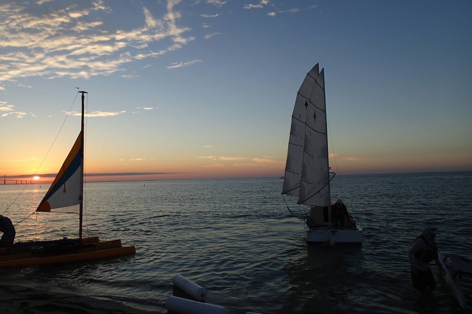

We were able to get our boat rigged and launched by 4pm Saturday. The tide would soon be turning and we had already had a long day so we spent the night tied up at the dock. There was a Spring tide and by morning we were partially aground, soft mud fortunately and not oysters. We planned to wait until almost noon when the tide would be near high so we would leave with the falling tide. When you have no motor your schedule is heavily influenced by the wind and tides.
Somehow we missed a tack on the way out Rabbit Key pass. The ebbing tide pushed us up against some mangrove trees and we were stuck. I knew this could be serious. If the mast hung up the increasing current could capsize us and or damage the boat. We struggled to push off the branches and free the boat, but we just wedged further into the mangroves. We got the sails down and tried paddling but to no effect. I got one of the oars out and was able to pole off the bottom. We pushed and paddled with all we had and slowly the stern swung free of the mangroves and out into the current. The increasing following current had limited the rudders ability to control the boat and our voyage had nearly come to a premature ending. Must be extra careful.


Sally was a little shaken by our near calamity and wanted to stop early. I encouraged her to keep on and promised to have us at anchor by 4pm. She felt better after awhile and was glad we continued on to Pavilion Key.
We had a quiet night just southwest of Pavilion Key. We decided to weigh anchor before dawn so we could make it to Lostmans River while the tide was flooding. That would increase our chances of making it up to Third Bay, or Lostmans River Bay.

Thanks to our early start we made it to the mouth of the Lostmans River by 8:30am. The tide was still pretty low so we had to pick our way carefully through the shoals at the entrance. Once we cleared Lostmans Island we found a little more water and with a flooding tide and a following wind we were making good progress. Much of the landscape in the lower Lostmans looked familiar to us from our trip three years ago. As we sailed up the river we were trying to locate our previous trips furtherest point of progress where we stopped for lunch before turning around continuing down the gulf coast. We passed the tower at the abandoned Ranger Station and then the water monitoring station.

When we saw Second Bay opening up before us we knew we were beyond our previous trip. We continued to have a favorable current and wind about 10knots almost dead astern. We crossed Second Bay and sailed between some island right into Third Bay.

We decided to stop for lunch in a little cove in Third Bay. We were really pleased to have made it all the way up to the Wilderness Waterway so easily. Over lunch we checked the weather and discussed our plans.

We could explore the Wilderness Waterway near the head waters of Lostmans River and then return back down Lostmans. Another possibility would be to head towards the Broad River. I did not know for certain that we could make it down the Broad River with our sailboat. The River might be too narrow or clogged with trees. We had two days of fair weather and then a strong front would come through bringing gusty northeast winds. We decided to take small steps towards the Broad River stopping along the way and reassessing our situation.

We headed south and east leaving Third Bay and following the Wilderness Waterway into Big Lostmans Bay. I felt like I needed to pinch myself. I could not believe we were sailing the Wilderness Waterway. The wind was about 10 knots west southwest. The bays are relatively small so there were only little wind waves and we glided across the water like magic. The bays are only a mile or two across at the most so our progress seemed almost too fast. Unlike sailing the Gulf or a large Bay where progress is not easily detected and it takes several hours to make your next landmark. Before we knew it we were across Big Lostmans Bay and hunting for the passage into Rogers River Bay. The passage opened easily before us and we dropped down into Rogers River Bay. We rounded up into a little cove and dropped our anchor. I checked for a cell signal and as I suspected found none. We had not had a signal since Pavilion Key, and that was a poor one. This was our Rubicon if we went any further south we were committing to the Broad River. We considered staying the night in our little cove but it was small and exposed to the south. We still had some daylight left and the conditions were near perfect. The Wilderness Waterway follows the eastern shore and goes through some narrow channels that would require sailing upwind around some marshy islands. We chose a route to the west that looked more open and favorable with this wind direction. Our course took us right by the Rogers River Chickee. Just a platform in a pretty little finger of a bay. There was no sign of anyone.

We rejoined the Wilderness Waterway sailing along the western edge of Cabbage Island. We began to get a little concerned because we were not seeing a good spot to anchor, but then poking into the entrance to the Broad River we found a wonderful little spot, protected on all sides and with a Cabbage palm tree to mark it.

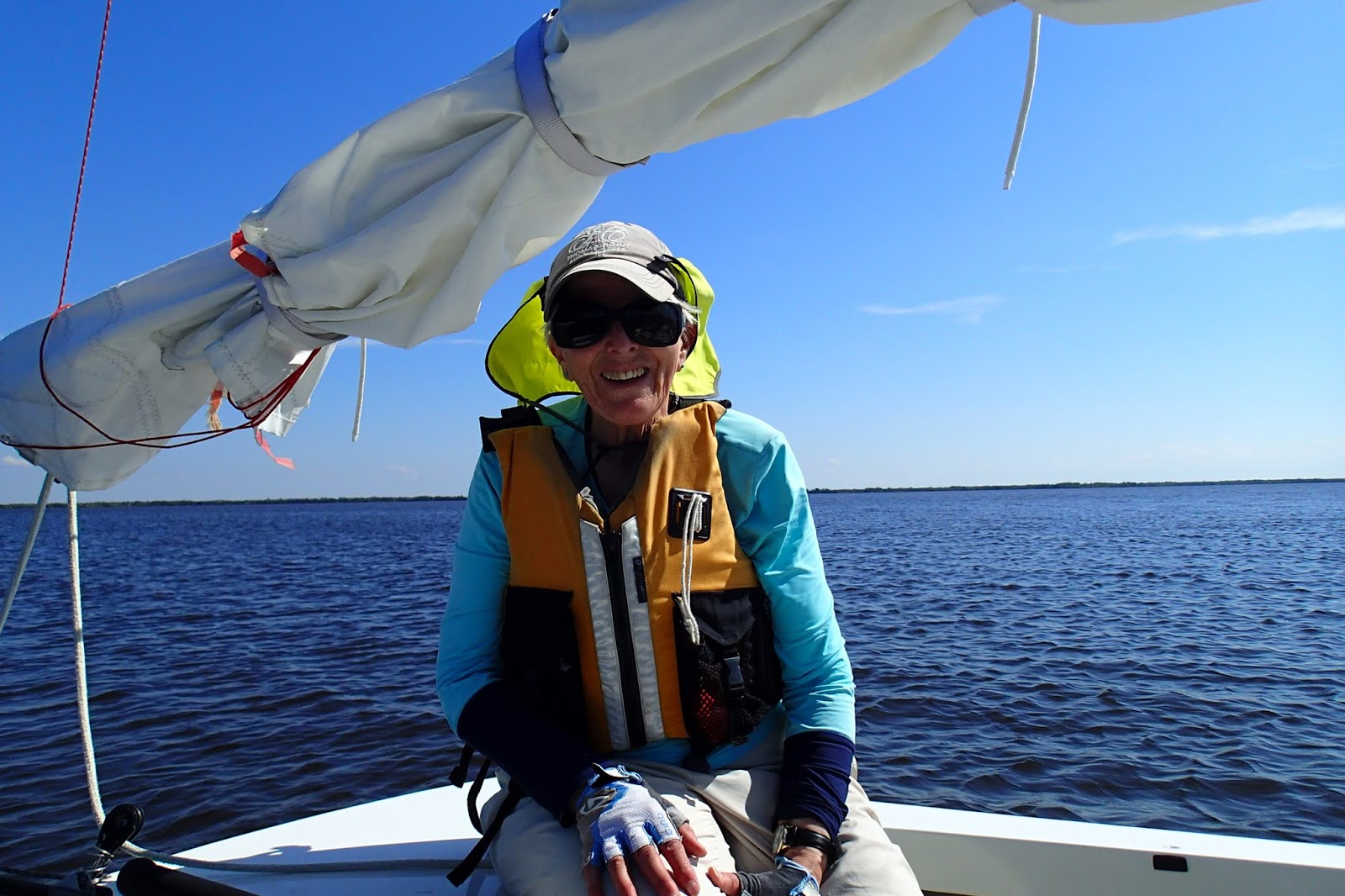
I think Sally looks pleased. We are in the heart of the Everglades about midway through our trip. Tomorrow we start working our way down the Broad River and back to the Gulf.
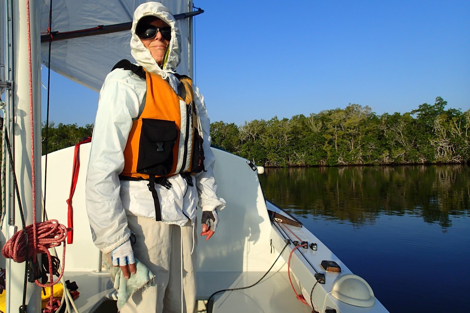
Tuesday morning was foggy with 5 knots of wind from the west. The current would be ebbing strongly in the morning so we decided to explore a bit around Cabbage Island until the current slowed a bit. There two ways to enter the Broad River. The Wilderness Waterway takes the Eastern branch which has a tight S turn. We thought this might cause a problem forcing us to sail upwind or around debris. We entered from the west which is wider and straighter and joins up with the other entrance in a half a mile or so. We started noticing Bromiliades. Flowering plants growing in the forks of dead trees. We lost our wind so we began to row slowly mostly to keep the boat centered in the river. The current was 1 to 2 knots. We noticed some shoaling when we met the eastern fork but no problems. The river was about 50 feet wide. No trees hanging in or over the water. Just quietly drifting watching for alligators.

When we reached the Broad River Bay we turned east towards Camp Lonesome. When the Bay began to narrow significantly we came about and headed west. The wind began to pick up veer west and with sharp gusts. Dark clouds rolling low and fast. The wilderness seemed a little less friendly. We were close hauled and tacking straight up the bay so progress was slow. We dropped anchor near the northern shore and tucked in a reef. We continued on until the bay narrowed and the river began. We anchored as close to the north shore as we dared and tied everything down well. We were expecting a strong front to come through overnight and the winds to increase and continue to veer to the north or northeast.

Below is the view looking west where the Broad River leaves Broad River Bay. This area has a tidal current of around 2 knots. The current flows west down river during the ebb tide, then it reverses and flows east during the flood. During the night the wind became quite strong and gusty form the north. When it was quiet in between gusts the boat would swing to line up with the current then a gust would come howling across the marsh and catch the boat broadside. The boat would shake and the masts fibrate as we swung to face the wind. Then the wind would ease and the boat would swing back to the current and several minutes later the wild gyration would repeat. Later we would learn that a veteran Watertriber would be forced to abandon his boat and call for a Coast Guard rescue in the Gulf not far from where we were swinging at anchor.

During the night we were surprised to hear voices and see a light in the distance. Watertribers no doubt making there way to Key Largo. Wednesday dawned clear, the wind from the NE 10 knots with some higher gusts. We considered leaving but decided to spend another day in the Bay to let the weather settle down. Later in the morning we spotted a few more Watertribers in kayaks some sporting sails heading west down the river. A couple of them came close enough to exchange a few words. They mentioned how wild the wind was last night.
Thursday morning dawned clear and cool. A manatee drifted down river I could only see a little of his snout as he surfaced to breathe. The sound of a large mammal surfacing to grab some air was unmistakable. We started down the lower Broad River under oars drifting slowly with the current. We were using the oars primarily to keep our boat centered in the river. After an hour or so the wind picked up and we put up our sails.

The sail down the lower Broad was beautiful but uneventful, but in the last 1/2 mile or so the river widens and is littered with small mangrove islands and sand bars. We were nearing the end of the ebb tide so the water was quite low. We followed a narrow channel of deeper water along the south bank of the river. I was relieved when we arrived at the mouth of the river but actually the most difficult part lay ahead. A huge delta stretches over a mile into the gulf most of it only a foot deep at low tide. Our GPS chart showed a narrow channel twisting off to the southwest through the shoal. The channel though is constantly shifting so we had to try to read the water for signs of the channel. The water color was not very helpful it was all various shades of light brown. After a few light bumps and scrapes we sailed free of the shoal and could set our course north towards Chokoloskee.

We stopped for a little shore leave at Plover Key. We had a pleasant walk along the sandy beach. We found lots of interesting drift wood and shells to admire.

We had some lovely visits from dolphins while at anchor near Plover Key, but they refused to pose for pictures.

Sally coming ashore at her favorite key in all of Florida. Turtle Key!

We marveled at the Mangroves that have adapted to live in this harsh spit of sand.

Turtle Key is four or five miles from Chokoloskee. You frequently see power boats and kayaks so it feels like you have returned to civilization. After 6 nights on our boat in the Everglades we were ready for a little civilization. We had no reservations and the first three hotels we tried had no vacancies, in desperation we tried the Rod and Gun Club and they had a room for us

A trip to Chokoloskee would not be complete for us without a meal at the Havana Café.

ReplyDeleteVery nice post.Custom boat Upholstery in Florida
Low Cost Boat Upholstery Services Florida
This comment has been removed by the author.
ReplyDeleteThis comment has been removed by the author.
ReplyDeleteCool
ReplyDelete